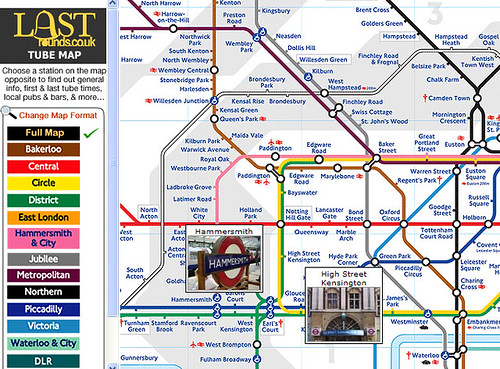
But now with the obsessiveness that I love about the internet, someone has painstakingly prepared a Tube Map that shows the first and last tube times for all the lines by station, and even visited Flickr and added a little picture of each station too.

When the page has loaded roll over the map and you get a little image of each station plus information about local pubs and their walking (or staggering distance) from the Tube station with a handy links to Google / Street and Tube maps. You can also change the format of the map to the line of your choice by selecting an option on the left.
The site - Lastrounds.co.uk is still fairly embryonic but it's perfect for planning a night out and is clearly a labour of love. Plus if you're ever caught short after chucking out time you can see where the nearest public loos are too.
I wonder why TfL doesn't employ some of people who create snazzy Tube Map applications or at least add links to them on their site? Over the years I've seen loads of interesting interactive maps but I don't think there's one place that lists them all. I'm sure that it'd make sense to acknowledge that these exist and working in some sort of partnership - or heaven forbid - have a day where people can deliberately play around with the map to see what sort of ideas come out. Maybe one day....
No comments:
Post a Comment