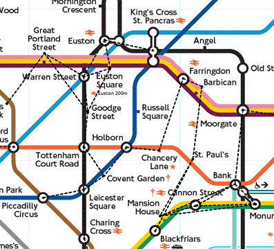
PruHealth got together with a team of volunteers with pedometers to count the number of steps between Tube stations in zone one and plotted them onto a map.
The BBC report that: "the average person would take 99 steps in walking between Cannon Street and Monument stations and 2,438 steps from King's Cross to Farringdon.
The British Heart Foundation recommends walking 10,000 steps per day. PruHealth said it would take the average person 75 minutes to walk that number of steps, but it would help protect them from stroke, diabetes and some forms of cancer."
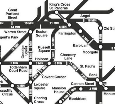
I wonder when we're ever going to get an official map from TfL which publishes information like this on a printed map? The "walk the Tube" map idea has been created before by students at Central Saint Martins College in 2007

This had the average times to walk between stations on it, rather than the number of steps.
Back in 2003 rodcorp came up with an idea of a map showing walkways between Tube stations showing where it's "quicker to walk on the Tube map".

I suppose that TfL would never be able to agree on what "average" walking times were. Although they do deliberately encourage people to walk between Leicester Square and Covent Garden or Holborn and Covent Garden, rather than travel the one stop by Tube.

The students seem to be much more optimistic than TfL with the walking times between those stations.
Admittedly, the Tube have those signs as an effort to reduce congestion and not a health kick. There must be many other journeys like this on the Tube, but I've never seen "walk rather than travel by Tube" displayed on any other in carriage maps. Maybe PruHealth should be encouraged to sponsor an official Tube pocket map, which would give loads more awareness to their campaign.
No comments:
Post a Comment