He said "Drawing my cues from the original and best metro diagram, H.C. Beck's wonderful London Underground diagram, I have rendered the Interstate system in a much simpler form. I have made the "major" highways (those divisible by 5) the framework of the map, with the "minor" highways reduced in importance and rendered as thinner grey lines..... A full key at the bottom indicates clearly where each highway begins and ends."
Thanks to richjm & Carole who both gave me the heads up to this! Tube map aficionados may say it's not exactly in the Beck's style, but Prime says he welcomes comment on the style and any errors or omissions!

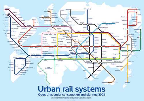
It also reminds me of Mark Ovenden's World Metro Map, a "playful diagram" showing "all the cities which have, are building or are planning to construct an urban rail system."
No comments:
Post a Comment